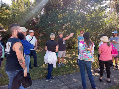
Our 2021 IGUIDB Walkabout route took us to the Welch area and vicinity. I have been thinking about this route for years, and leaned away from it because I was not sure how to make it interesting, and also felt that it was a long route. Once I mapped it out, I was amazed that the entire course was only around 3.5 miles! We covered a lot of ground, and it was actually far more interesting than I thought it would be. We made a lot of observations, chatted and made some new friends, and walked off Thanksgiving. Here is an outline of our activity this year. This will be a great read not only for those who went on the walk, but also for those who missed it and have an interest in the local history of Daytona. While my historic contexts SHOULD be correct, this is an informal report and I do not guarantee accuracy on exact dates/facts/figures, but share my info to the best of my knowledge.
We did take note that two events were very key in the shaping of this area, the depression in the 20s, and the war in the 40s.
Chapter 1: Daytona Mall
Chapter 2: West Second Avenue/White Street
Chapter 3: Stadium/Welch Area
Chapter 4: Hospital / College Campus
Chapter 5: Volusia Avenue
Chapter 6: Daytona Highlands
Chapter 7: Tuscawilla and Rosella Park
CHAPTER 1: DAYTONA MALL
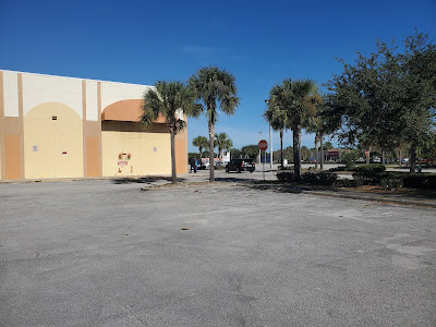
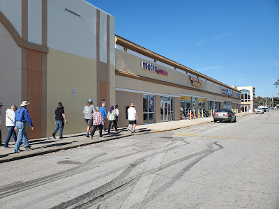
Our meetup spot was at Daytona Mall, in the south parking lot by Steak and Shake. This would prove to be the only sketchy part of the walk, as the mall is largely abandoned and vacant on the south side, and there are a handful of businesses operating on the east side. There seems to be a lot of activity in the area, but the mall is a shadow of its former self.
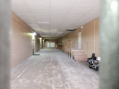
Entering the mall entrance, the corridor is largely vacant with the exception of maybe 3 businesses catering to hair and nails. (We got to the dead end at the nail place and I asked the lady if she could handle us for 30 mani-pedi's, HAHA! The look on her face.) All other access has been cut off. The area in the rear where the movie entrance used to be is fenced off and there is a state probation office located there. An automotive shop is operating in the old Zayres automotive space. The parking lot out back still has as many potholes as it did back in the day.
Overall, the mall is in neglected condition, and was the only spot on the walk where we encountered any street people / homeless people. It was easily the most sketchy part of the walk.
Historically, the land that the mall sits on was part of the original holdings of Mason and Coleman. The property that the mall is on stretched from just east of White Street all the way to the river, bordered to the south by the Spanish canal that stretched from the river near the old Mainland campus, west to the airport property. As it was subdivided, the lot had farmland and vacant acreage until the 1950s when Westgate Plaza was constructed.
There was still operating farm land behind Westgate Plaza after it opened, operated by the Cone family. The area where the former Medical Arts building and the clinic are today was the site of the Volusia Drive In. The drive in property was developed when the Westgate Plaza was expanded. Montgomery Wards arrived, and the outparcel where the clinic is was the site of their Automotive Center. After Wards closed, many other tire shops, including Stevens, found a home there for awhile. Ultimately the plaza was converted into the Daytona Mall. For a short time the mall was relevant to the area, with anchor stores such as Wards, Zayres, Winn Dixie and the theater...great arcades, record and clothing stores, and food options including the Pappys and the Orange Owl. The Orange Owl was originally a franchise called the Orange Bowl, and when they gave up the franchise, they took off the B.
Over the years, tenancy has dropped, the layout reconfigured and anchors to the south came and went, including Circuit City and Burlington Coat Factory.
While we were in the parking lot, waxing nostalgic, we looked across the street at the Krispy Kreme, a fixture on the corner since 1962. We remembered the dairy behind it and the building shaped like a milk bottle. That was demolished to make way for Mims Lincoln Mercury in 1969. The Winn Dixie left the mall and moved across Nova to a free standing building. A&P took the spot where WD had been at the plaza. We remembered the Chick Nik at the outparcel close to where Steak and Shake is today. The Westgate Plaza has a strong area legacy among those of us of a certain age.
HISTORIC CONTEXT:
The Cone Farm behind the Plaza, 1963
CHAPTER TWO: WEST SECOND AVENUE / WHITE ST
We continued our walk from the mall property, and headed west on Second Av...that is, Mary McLeod Bethune Blvd. One had to note how lovely that area is these days. The residences all seemed tidy and well kept and loved. Walkers were noting which houses they had lived in, or that were constructed by family members.
Making our way to White Street, we came to the college campus, Greenwood Cemetery and Mt. Sinai Cemetery. I do not have exact history on the Greenwood, but it is the older of the two. Some references have it founded before the turn of the century (one reference said 1869!). Mentions in the 1920s have it described as being on West Second Avenue. Mount Sinai was founded in 1937 by Harry Pepper and Mack Roth with help from Harry Haigh of Haigh-Black, to fulfill the need for a Jewish cemetery.
White Street is an amazing wide roadway. The residences along the route for the most part are very tidy and well kept. Only one abandoned home.
We continued north to Willis Street, at the Blind Services Center. All of the property in this area was extremely well maintained.
HISTORIC CONTEXT:
CHAPTER THREE: Stadium / Welch Area
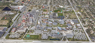
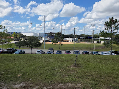
Heading west on Willis to Heineman took us past the Welch area. Historically, this was an area that flourished during WW2 when the military took it over and established their presence there. The military commandeered the hospital and used the Welch pools for therapy for injured soldiers. There were training facilities and a strong WAC presence here. This was a vital area during WW2, and after the war, everything was sold off as military surplus. Some of the quanset huts went on to service in other parts of the city, notably near State Av and 10th St in Holly Hill where several are still standing. This was the genesis of the Mary Karl school which eventually evolved into Daytona State College. The campus has spread and taken over most of the Welch area. It is a beautiful and well thought out campus.
WAC Cantonment
In 1954, discussion to build a high school where the college is now.
Locals will remember many icons of the past from this area, including Skateland, Welch Pool, Highlands Presbyterian (before they moved to Derbyshire), Highlands Elementary, racquetball courts, and much more!
It is difficult to encapsulate the area currently with photographs, but you could drive around it virtually using Google Maps.
CHAPTER FOUR: HOSPITAL AND COLLEGE CAMPUS
Walking south on Heineman from Willis, you are instantly enveloped by the Hospital to the west and college to the east. The hospital now stretches from Willis south to ISB. It is an massive sprawling campus. The college has taken over most of the Welch area and all the property from Heineman to White Street. Both the hospital and college grounds remain well maintained despite their growth and size.
Highlands Elementary now being used as industrial space for the college
CHAPTER FIVE: VOLUSIA AVENUE
We made the observation that most of us had not been on the sidewalk along this corridor since our school days. From the hospital campus, we peered over to the KMart Plaza and remembered things from the past like the Brundage Trailer Park, Sherrys, Curbys and other iconic businesses. KMart came around 1970. The Mainland Campus in 1962. All of this was outside of city limits at the time, on the outskirts of "the boonies" back in the day. The city grew west to meet the developments.
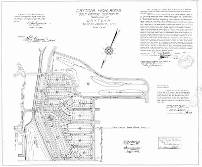
So, how and why has the hospital been in that prime area since the 1920s? Likely due to the land boom of the 1920s, before the depression. All of the area there was platted out as a golf community. None of the development west of the current Highlands at Tarragona area ever came to fruition. When the plaza was constructed for KMart, the county formally abandoned the roadways that were platted underneath...some likely used by the trailer park that was there.
The leg of ISB from the airport to Nova is heavily travelled, the main corridor thru the heart of the city. The view of the hospital, college and school campus are impressive to passersby, and even more intimidating while walking slowly past. Regrettably, a strip plaza has appeared at the eastern side of the high school campus, pushing toward the arch. Daytona Highlands is fighting back to prevent such development, but could not stop this from being constructed. That said, it is not a horrible looking plaza and likely serves the college and high school students well.
Clearing land for new campus in 61
Daytona Highlands appeared during the land boom of the 1920s and was laid out with plans for Spanish style architecture homes. The arch at Tarragona was the grand entrance. Originally, Volusia avenue was not the main thoroughfare out of town. Bellevue was the route to DeLand out of Daytona. Before WW2, Volusia was not a main route, with very little development past Lakeshore Dr (Clyde Morris). The arch had two sides originally, one to Tarragona, and one west on Volusia. When Volusia was widened in the 40s to provide access for military vehicles for defense, and to access the Welch area, the northern half of the arch was demolished.
In 93, when 92 was further widened, there was talk about demolishing the remainder of the arch. Instead, the arch was jacked up, put on rails and rolled to its current location, slightly SW of the original location.
Daytona Highlands still retain many of the original Spanish architecture homes, and they also have a mix of great mid century modern homes. It is still a desirable area to live in, and homes in that area command good prices. Most all seem tidy and well maintained. The home pictured below was for sale for $450,000.

CHAPTER SEVEN - TUSCAWILLA PARK
At the main entrance to Tuscawilla Park, we are greeted by the War Veterans Memorial that was previously in Riverfront Park back in the day, until it was eventually moved into storage then set up at Tuscawilla.
Tuscawilla was originally private property held by the Highlands Corporation and sat in a natural unmolested habitat. It was platted for development as a subdivision called Tuscawilla Park, with street names all named for Native American Indian tribes.
There had been much discussion among nature lovers that the city should purchase the land and preserve it. After many many years the city finally bought it, around 1948. Alys Clancy and the garden club were very active in this campaign, and in the efforts to utilize the space and make it a city asset. In 1969 there was a full blown renovation of the park that created most of the paths and ponds that are there now. There was talk of a full rec facility that never came about. In more recent years, the park has become the home to Frisbee Golf enthusiasts, and a zipline has been installed on the northern end of the park that is popular.
The property just to the west of Tuscawilla is known as Rosella Park. That was considered in the purchase of Tuscawilla as well. Rosella was the name of the owners wife. We cut over to Rosella Park, walked thru the church property back to 92, and crossed back to our cars, ending our annual walkabout.
We crossed over by Frederick street, and looking at the office buildings and bank there reminded me of when they decided to build a bank on the north side, that the family who lived there opted to move their house, rather than demolish it. They moved it off that corner in the 70s, and all the way to the western dead end of 6th Street, at the edge of what was woods back then. The house still stands at that dead end today.
IN CONCLUSION - OUR TAKEAWAY
Everyone says how horrible this town is, and to be crude, what a shithole it is. We were waiting to find the horrible part, but we just never saw it. To be fair, the mall area was the sketchiest site of our day, and once we headed away, we were hard pressed to find ANYTHING to complain about. EVERY property seemed tidy and well maintained. We were not accosted or endangered at all. We did not see a speck of litter, did not see any derelict property to be embarrassed about. While we expected disappointment, we found a great little area. Several of us mentioned we would be perfectly happy living there...especially in the Highlands. It was sad to see some of the changes, but many have been done quite well, and as is the case of the schools and hospital, quite beneficial to the area.
So when you really want to see a city, get out and walk it and explore. Get to know your city first hand. It might just surprise you. Hope you enjoyed the coverage of this years walk. If you have any questions, see any mistakes or if I forgot anything just let me know.
See you next year. If you have a suggestion for next years walk, be sure to let me know.
Harry














No comments:
Post a Comment